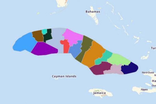
CUBA PROVINCES
- Territory Guide
- CUBA PROVINCES
Cuba provinces are a vital map territory for many decision makers in several aspects.
Take a few minutes to build a map of Cuba Provinces.
A CLOSER LOOK AT CUBA PROVINCES
You can easily create a map of Cuba provinces using Mapline. The Republic of Cuba covers the islands of Cuba, Isla de la Juventud, and several other groups of islands in the Caribbean Sea. The country is the largest island in the Caribbean. Its capital and largest city, Havana, is just 365 km away from Miami, Florida in the USA. Although Cuba is part of North America, in cultural term, it is part of Latin America.
Using Mapline, you can easily create a map of Cuba provinces. Cuba is made up of 15 provinces and 1 special municipality. The provinces are further divided into municipalities.
ADD CUBA PROVINCES TO MAP
Let’s say you’re an industry leader wanting to make a province-level analysis to visualize opportunities and potentials of each province. The perfect way to start is to add territories to your map – in just a few seconds! How awesome is that?
In Mapline, adding territories become just like a few snaps of a finger. Even if our Repository stores a wide range of territories, it still takes a few seconds to add the territory because of the search bar. Try typing in CUBA and choose CUBA PROVINCES.


Pro Tip: Aside from the province boundaries, you can also add Cuba municipalities if you want to concentrate on analyzing geographic aspects in a smaller scale.
CHOOSE PROVINCIAL COLORS
Now that we’re getting warmed up, here’s the more exciting part – assigning colors to your territories! Impressive, right?
Assign the territory boundaries in different colors or in uniform color – it’s all up to you! Colored territories take your analysis up a notch because you get to dig valuable insights for informed decisions.
Hit OK when you feel satisfied with the result.

GET NEW TERRITORY INSIGHTS
That’s how easy it is to create a map showing all the provinces of Cuba! Once you have your map, you can create a map of Excel spreadsheet locations to overlay on top. Mapline also makes it simple to see summary information about the locations inside each province just by clicking on them! Sign up now to create a map of Cuba provinces.


