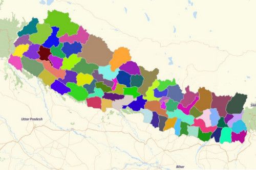
NEPAL DISTRICTS
- Territory Guide
- NEPAL DISTRICTS
Let’s make the best use of a Nepal District map. Take your analysis on a district-level and uncover trends and patterns in minutes or even in seconds!
All that and more when you start creating a map of Nepal districts.
A CLOSER LOOK AT NEPAL DISTRICTS
Nepal is a South Asian country located in the Himalayas. It is the home of the highest mountain in the world – Mount Everest. Agriculture is the main economical factor followed by services, and manufacturing and craft-based industry. Agricultural products include corn, rice, root crops, sugarcane, tea, and wheat.
Using Mapline, you can easily create a Nepal district map. As of 20 September 2015 Nepal is divided into 7 provinces and 75 districts.
ADD NEPAL DISTRICTS TO MAP
How do you start creating a map of Nepal districts? It’s very easy, actually. Follow these simple steps and you’ll be adding the district territories in no time.
By leveraging the district boundaries of Nepal on your map, you’re one step closer to identifying all valuable location aspects that may affect certain communities thus affecting your business too. Can you imagine that? The power to analyze socio-economic factors is in your hands!
From the left side of your map, click the ADD button to select FROM MAPLINE’S REPOSITORY. To ensure that you have the right territory, type in NEPAL into the search bar and choose NEPAL DISTRICTS.
And there you have it!


Pro Tip: Mapline’s Repository is packed with territory boundaries of Nepal for your convenience of use – districts, regions, villages, and zones.
CHOOSE DISTRICT COLORS
Now, let’s turn your attention into applying something simple yet powerful into your map. It’s adding colors to your territories. Just by adding colors, the district boundaries will turn to be a goldmine of ideas for informed decision making. Yes, your map will be an eye candy for your audience. But it’s just the bonus. Choosing the right color style actually ignites ideas that can be used to create future plans for sustainable communities, gain new business perspectives, and identify growth opportunities.
Whatever color style you choose, a color-coded terriotry leads to a deeper understanding of district boundaries.

GET NEW TERRITORY INSIGHTS
That’s how easy it is to create a Nepal district map! Once you have your map, you can create a map of Excel spreadsheet locations to overlay on top. Mapline also makes it simple to see summary information about the locations inside each district just by clicking on them! Sign up now to create a Nepal district map.


